Category:St Combs
Jump to navigation
Jump to search
village in Aberdeenshire, Scotland, UK  | |||||
| Upload media | |||||
| Instance of | |||||
|---|---|---|---|---|---|
| Location |
| ||||
| Population |
| ||||
 | |||||
English: St Combs is a small fishing village in Aberdeenshire, Scotland immediately southwest of Inverallochy near Fraserburgh which has existed since at least the 17th century. It takes its name from from a church to St Colm or Columba that used to exist in the area.
Subcategories
This category has the following 2 subcategories, out of 2 total.
S
- Ships registered in St Combs (1 F)
- St Combs railway station (4 F)
Media in category "St Combs"
The following 39 files are in this category, out of 39 total.
-
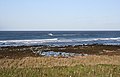
 Beach south of St Combs.jpg 640 × 410; 198 KB
-
 Inzie Head and St Combs from the air - geograph.org.uk - 5295294.jpg 1,024 × 682; 156 KB
-
 North of Inzie Head - geograph.org.uk - 4469279.jpg 640 × 409; 335 KB
-
 Remains of Inverallochy Castle - geograph.org.uk - 614169.jpg 640 × 480; 50 KB
-
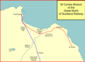 St combs branch.png 985 × 719; 42 KB
-
 Bailiff's Skelly - geograph.org.uk - 568494.jpg 640 × 427; 247 KB
-
 Beach and dunes near St Combs - geograph.org.uk - 562692.jpg 640 × 480; 86 KB
-
 Beach at St Combs - geograph.org.uk - 562686.jpg 640 × 480; 79 KB
-
 Beach at Whitelinks Bay - geograph.org.uk - 360748.jpg 640 × 480; 108 KB
-
 Bellman's Croft - geograph.org.uk - 420215.jpg 640 × 427; 245 KB
-
 Cairness House - geograph.org.uk - 420319.jpg 640 × 428; 222 KB
-
 Cemetery at St Combs - geograph.org.uk - 360755.jpg 640 × 480; 110 KB
-
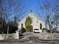 Church at Mosstown - geograph.org.uk - 360761.jpg 640 × 480; 158 KB
-
 Coastal path out of St Combs - geograph.org.uk - 391410.jpg 640 × 480; 75 KB
-
 Coralhill - geograph.org.uk - 420268.jpg 640 × 314; 166 KB
-
 Crimonmogate Mains - geograph.org.uk - 313731.jpg 640 × 427; 262 KB
-
 Ditch and sand dunes, south of St Combs - geograph.org.uk - 556690.jpg 640 × 480; 126 KB
-
 Fiddler's Green - geograph.org.uk - 313701.jpg 640 × 427; 240 KB
-
 Fiddlers Green - geograph.org.uk - 420201.jpg 640 × 365; 218 KB
-
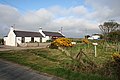
 General Store at Gowanhill Crossroads - geograph.org.uk - 438695.jpg 640 × 480; 98 KB
-
 Hallmoss Farm - geograph.org.uk - 435772.jpg 640 × 480; 80 KB
-
 Hillhead - geograph.org.uk - 420277.jpg 640 × 427; 216 KB
-
 Lonmay - geograph.org.uk - 420208.jpg 640 × 427; 252 KB
-
 Looking towards Cairness House - geograph.org.uk - 330000.jpg 640 × 480; 46 KB
-
 Lower Tyacksnook - geograph.org.uk - 313708.jpg 640 × 260; 121 KB
-
 Meadows - geograph.org.uk - 420293.jpg 640 × 358; 148 KB
-
 Netherton - geograph.org.uk - 420241.jpg 640 × 330; 183 KB
-
 Old Kirkyard at St Combs - geograph.org.uk - 356924.jpg 640 × 480; 99 KB
-

-
 Pond at 'Chavadrek' - geograph.org.uk - 435769.jpg 640 × 480; 77 KB
-
 Potato field at Strathstodley - geograph.org.uk - 438705.jpg 640 × 480; 79 KB
-
 Quarryhill - geograph.org.uk - 420221.jpg 640 × 427; 227 KB
-
 Rathen East Kirk - geograph.org.uk - 420303.jpg 640 × 532; 289 KB
-
 Sheep on seaside sandy bank, St Combs - geograph.org.uk - 562702.jpg 640 × 480; 100 KB
-
 St.Combs Beach at Sunrise - geograph.org.uk - 585790.jpg 640 × 480; 61 KB
-
 Track though dunes, St Combs - geograph.org.uk - 562697.jpg 640 × 480; 83 KB
-
 Tufted Duck Hotel, St Combs - geograph.org.uk - 356901.jpg 640 × 480; 78 KB
-
 Upper Ridinghill - geograph.org.uk - 395793.jpg 640 × 480; 62 KB
-
 Woodhead - geograph.org.uk - 420285.jpg 640 × 415; 227 KB


